I don’t remember exactly where and when I saw a beautiful photo of Wilpena Pound (Ikara) in Flinders Ranges National Park. That photo of a natural amphitheatre of mountains was made from the airplane and was simply stunning! You could probably imagine what happened after I realised that Flinders Ranges is not far away from us (only 1200kms) - I started planning when we are going to visit this magic place.
We spent a lot of time trying to figure out when is the best time to visit Flinders Ranges National Park and, more importantly, what to see and to do there. The problem was that there was too much information in the internet with names, places and points of interest in Flinders Ranges. I spent days trying to figure out where, for example, ‘Brachina Gorge’ or ‘Arkaroo Rock’ are located, what should we do there and, more importantly, when it is the best time to visit that place.
In this post I am going to share some useful information with you.
Technically, there are Southern, Central and Northern Flinders Ranges. Southern Flinders Ranges is a South Australian wine region, located to the east and north-east of Port Pirie. As this region is located not far away from Adelaide, we decided to leave it for another trip and focused on Central and Northern Flinders Ranges.
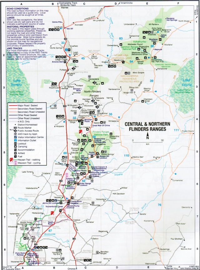
At the moment when I write this, I can say that the best Flinders Ranges maps and documents are these:
First map is this one:

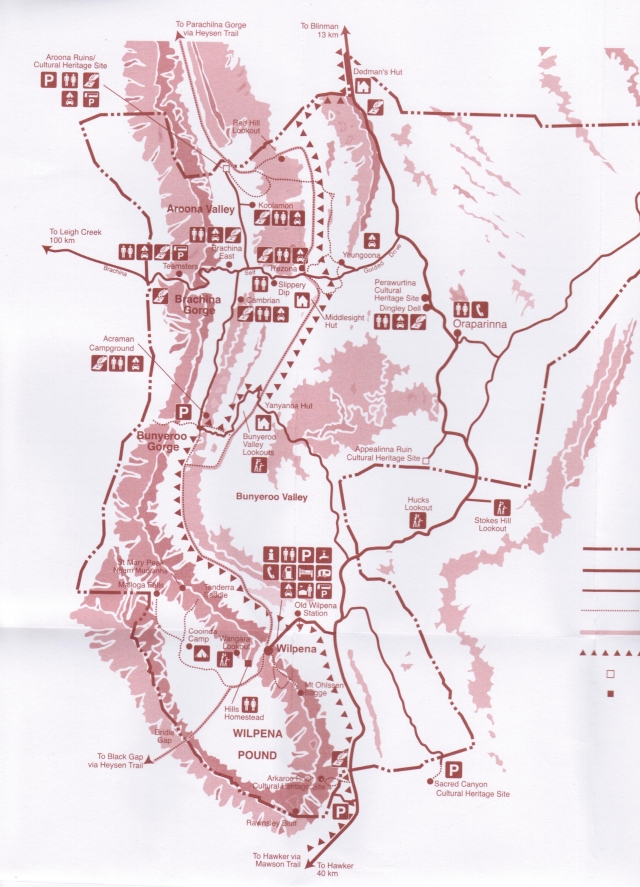
This one is the same, but doesn’t have some details:

There are also two outstanding documents, prepared by Department of Environment and Natural Resources of South Australia. First one called "Bushwalking in Flinders Ranges National Park", and the second one is "Flinders Ranges National Park". You can probably get them from the information centre in Hawker, but I recommend you to read both of them before your trip. Both of them have good explanations and walks descriptions, which are very helpful.
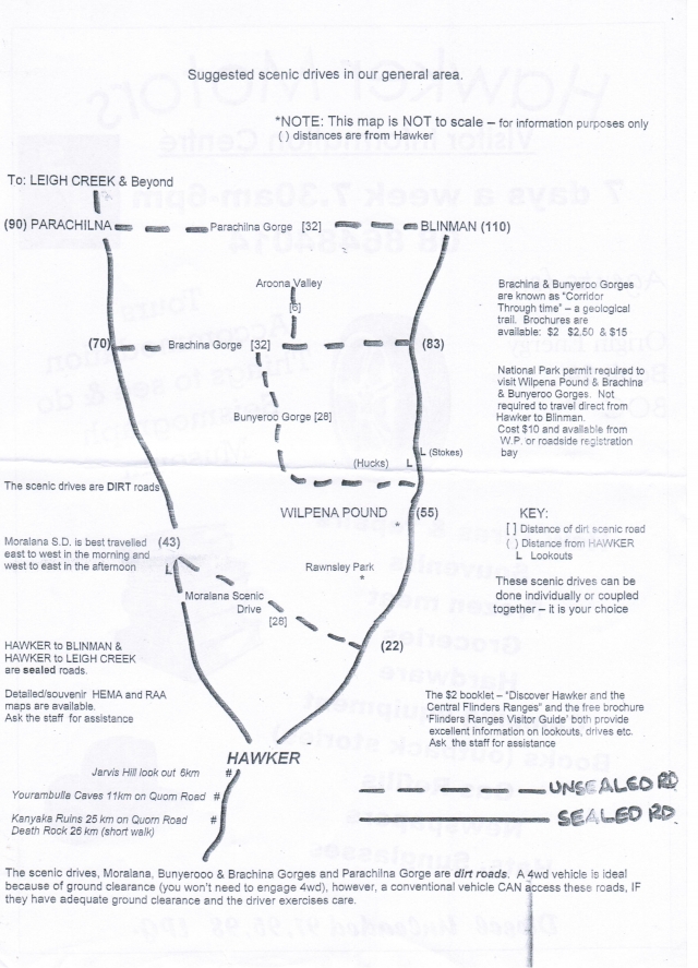
In Wilpena Pound resort we’ve got this document as well. Technically, it is not a map - it is just a simplified version of the area, but is useful as well, as you can see main recommended scenic drives.

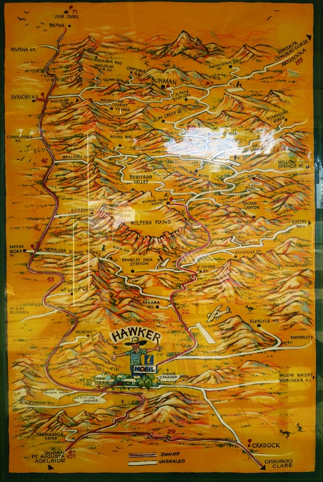
Finally, in Hawker, I found the BEST map (well, it is not a map, it is actually an image on the wall near the information centre) of the Flinders Ranges area. All main attractions and terrain are marked here. I wish I had this image before we went there :) It could save me a lot of time.

As we planned to spend 1,5 days in Flinders Ranges, we decided to see and to do following:
Day 1. Kanyaka Homestead Historic Site, Yourambulla Caves, Hawker (coffee, fuel), Arkaroo Rock Hike, Rawnsley Bluff Lookout, Sacred Canyon, Wangarra Lookout. Night at Wilpena Pound Campground.
Day 2. Bunyeroo Gorge, Bunyeroo Gorge Hike, Brachina Gorge Geological Trail, Moralana Scenic Drive on the sunset. Night at Wilpena Pound Campground.
Day 3. Way back.
There were some other places that we wished to see and to do like to climb St Mary's Peak (full day), visit Great Wall of China (on the sunset), Cazneaux Tree (anytime), Stokes Hill Lookout (on the sunset as well), but as we had not had enough time (as usual) we left them for the next visit.
In fact, we visited all placed and even more, except Bunyeroo Gorge Hike, as simply missed the turn, and Brachina Gorge Geological Trail, as we had to go back to Hawker for tyre fix.
Anyway, it was a good 1,5 days trip. I will tell with more details about it in my next post.
